Philadelphia Weather: Rain Changing To Wet Snow Overnight Expected To Create Messy Wednesday Morning Commute
PHILADELPHIA (CBS) - Ready for weather whiplash? Big changes are in store over the next 24 hours. We go from highs in the 50s and 60s on Tuesday to highs in the 30s Wednesday, all thanks to a cold front that will move in this afternoon.
Colder air will move in behind the front and this cold air should catch up to some lingering moisture overnight. Rain should change over to wet snow (big flakes) closer to midnight and will continue into early Wednesday morning. Overall, this is not going to be a big snowstorm. Sorry kids! But since it comes during the morning rush, we will likely have some problems on the roads.
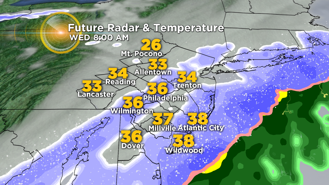
Temperatures should remain above freezing for many as the snow falls. If this solution verifies, then roads should be mainly wet and maybe a little bit slushy. If we get the snow to come down heavy enough, then we can overcome the warm ground and temperatures could drop closer to freezing. This would allow bridges, overpasses and untreated roads to become slick.
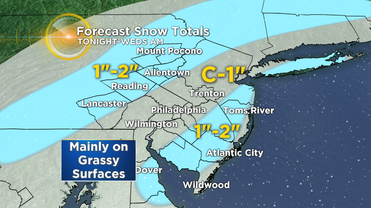
As far as accumulations go, a coating to 1 inch of snow will be possible across Philadelphia and the surrounding suburbs, mainly on grassy areas, decks, cars and elevated surfaces. We may see 1 to 2 inches across the Lehigh Valley and across South Jersey, again mainly on grassy areas.
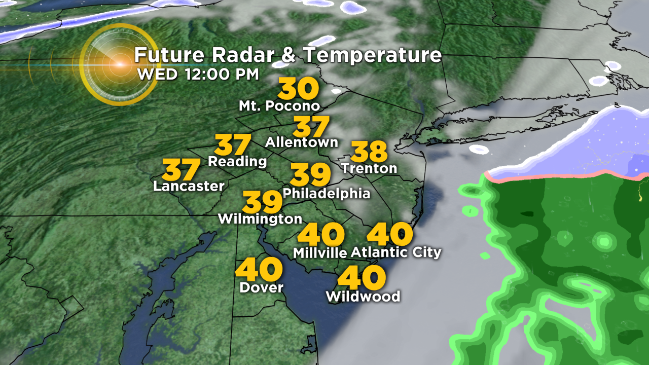
After a messy morning commute, expect to dry out and the clouds to clear out, giving way to plenty of afternoon sunshine. It will be much colder with highs only in the upper 30s. Thursday will likely be the coldest day out of the next seven with highs only in the mid-30s.
Be safe everyone and stay tuned to CBS Philly for the latest forecast.
By: Meteorologist Tiffany Savona