Philadelphia Weather: Delaware Valley At Risk For Gusty Winds, Torrential Downpours As Strong Storms To Move Through Area
PHILADELPHIA (CBS) -- A severe thunderstorm watch is in effect until 10 p.m. for Philadelphia and the surrounding suburbs in Pennsylvania and New Jersey. Strong storms are expected to move into the western portion of our region by 6 p.m.
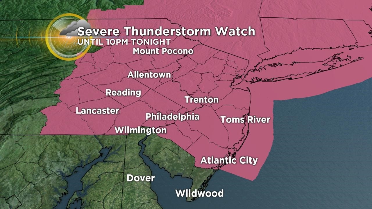
The area is at risk for gusty winds, torrential downpours and frequent lightning. As of right now, the threat for hail and an isolated tornado remains low.
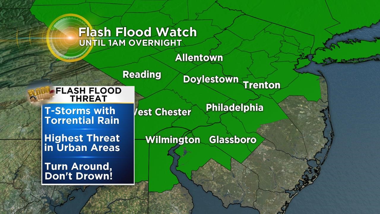
There is also a flash flood watch in effect for the region until late tonight. Heavy rain will increase the risk for flash flooding. Remember, low-lying areas flood first and do not drive into flood waters.
The heat indices for the area Wednesday have been above 100 degrees. On Thursday, our high temperature will be about 90 with a chance of scattered downpours and storms throughout the day.
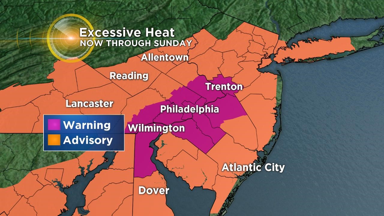
We can expect this weekend to feel even hotter. We are under an excessive heat warning until Sunday at 10 p.m. as high humidity lingers and temperatures stay above 90 for the area.
On Friday, the high will reach 97 and heat indices will be above 100 again. Saturday will have a high of 100 and feels-like temperatures will be up to 115 degrees.
Make sure that you stay hydrated, only go outside if you have to, and remember your pets over the next few days. It only takes 10 minutes for a car to become dangerously hot. Our relief from the heat will not be until next week.
CBS3's Sloane Haines reports.