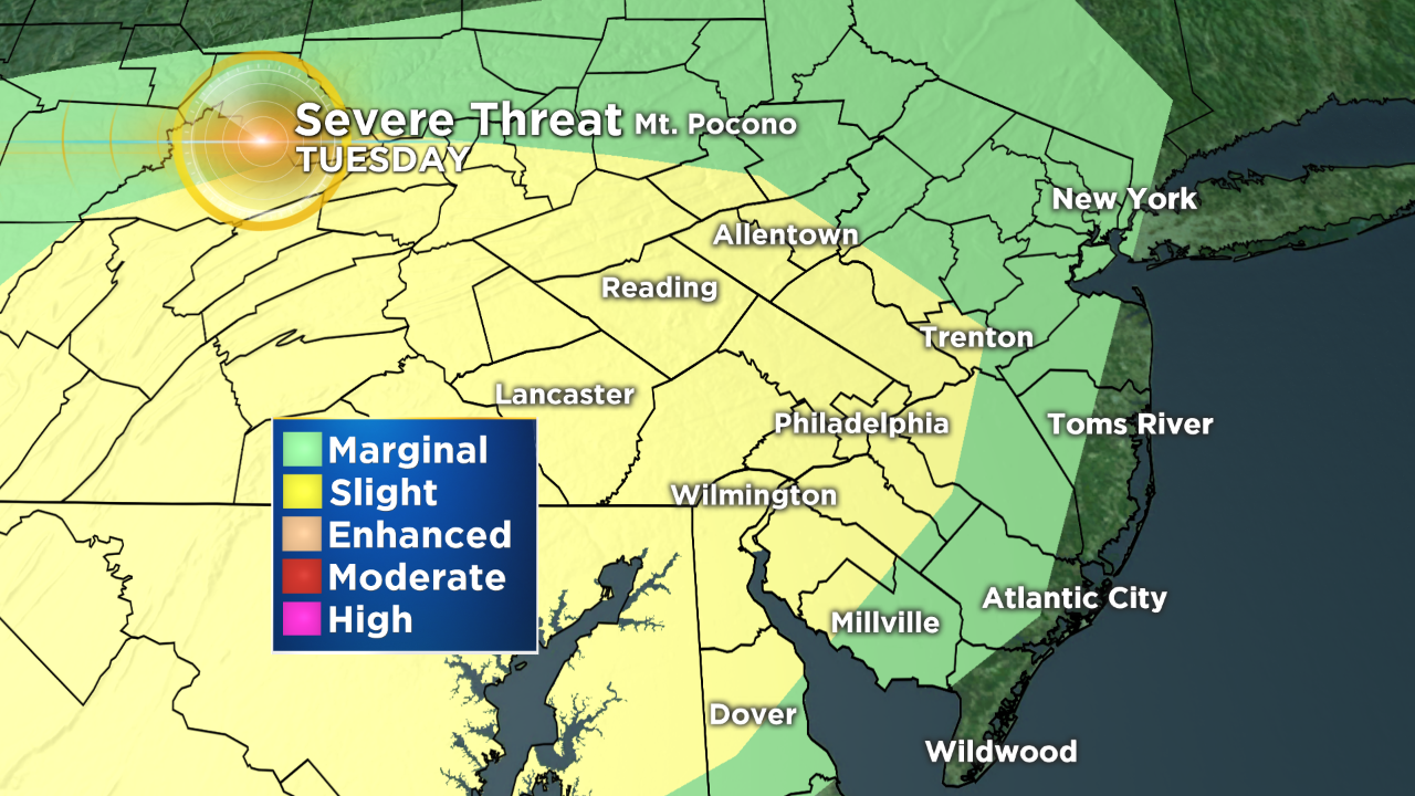
Cold Front Sparks Severe Weather Chances On Tuesday
Follow CBSPHILLY Facebook | Twitter
PHILADELPHIA (CBS) -- A very unsettled weather pattern will be taking over the region for the next week or more thanks to a blocking area of high pressure to the east and a stalled front to our south.
Thanks to the large area of high pressure, the front will not be able to clear the region and is likely to pass back over the region on Monday in the form of a warm front. This will allow for temperatures to climb back into the 70s and starting to filter in some humid and less stable air over the Delaware Valley. The trend of destabilization is going to continue on Tuesday. That is when we will likely have the greatest threat of severe weather this week.
On Tuesday, we will have a pretty textbook severe set up taking place. While there will likely be some shower or thunderstorm activity early in the morning hours on Tuesday, it will not be enough to balance out the effects of what should be substantial afternoon heating across the region.
Tuesday afternoon will be hot and muggy, with sunshine as we climb into the upper 80s for much of the area. This is likely to lead to surface destabilization through the afternoon hours. So, by the time the cold front sweeps back across in the latter half of the afternoon and the early evening, the atmosphere will be ripe for the taking when it comes to storm formation.
Right now it looks as though the front will push through after about 4 p.m., starting north and west of the city and slowly sweeping all the way through the Delaware Valley. This means that all portions of the region should be on the lookout for the severe storm on Tuesday. The biggest threats at this time are going to be strong winds, thanks to the linear structure of the storms along the front, followed by a chance for some hail to develop as well.
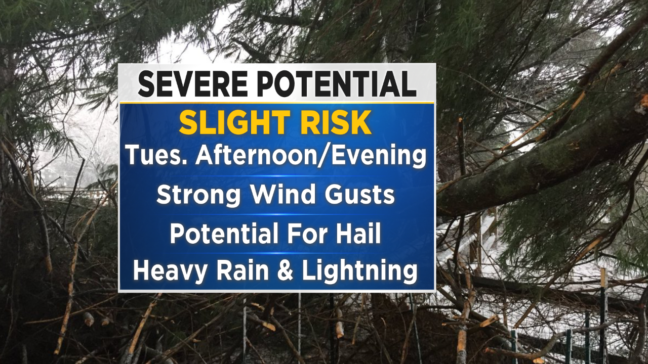
As of right now, the good news is that tornado formation is not likely with this system. As always, though, we need to stay aware of heavy downpours and dangerous lightning. The cold front then again stalls to the south, allowing for showers to remain in the forecast through the middle of the week.
This will be an evolving forecast for the next 36 to 48 hours for the region, so make sure you are staying up to date on the forecast and weather aware by staying tuned to the CBS Philly Weather team and you can always follow the forecast online at CBSPhilly.com or with our weather app.
TODAY -- Areas Of Morning Drizzle and Patchy Fog, Then Mostly Cloudy and Warm. High 78
TONIGHT -- Partly Cloudy Skies, Mild and Muggy, Showers Develop Toward Sunrise. Low 64
TOMORROW -- Morning Rain Showers, Then Clearing Out, Late Day Thunderstorms, Could Be Strong To Severe. High 89
WEDNESDAY -- Overcast With Spotty Rain Showers. High 75
THURSDAY -- Mostly Cloudy, Scattered Showers. High 79
FRIDAY -- Overcast With Showers and Storms Around. High 68
----------------------------
JERSEY SHORE:
TODAY -- Morning Fog and Drizzle, Then Mostly Cloudy. High 73
TONIGHT -- Partly Cloudy Skies. Low 64
TOMORROW -- Partly Cloudy, Late Day Thunderstorms. High 84
OCEAN TEMP: 57°
----------------------------------
POCONOS:
TODAY -- Morning Drizzle and Fog, Then Mostly Cloudy and Warm. High 70
TONIGHT -- Partly Cloudy With Spotty Rain Showers. Low 62
TOMORROW -- Morning Rain Shower, Some Clearing, Then Thunderstorms Developing, Could Be Strong To Severe. High 77