WEATHER BLOG: April Snow Showers?
PHILADELPHIA (CBS) - A messy start to April is on tap as another dose of Winter Weather makes its way through the region starting on Sunday night and lasting through the morning hours on Monday.
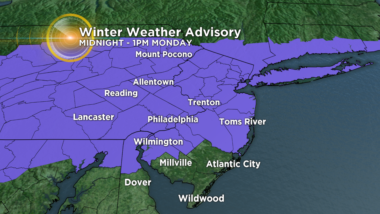
A Winter Weather Advisory will go into effect at midnight on Monday and last until 1 p.m. This Advisory includes all of Southeast Pennsylvania into the Lehigh Valley and Poconos as well. Most of New Jersey is included in the Advisory as well, same for the far southern reaches where most of the precipitation on Monday should fall as strictly rain.
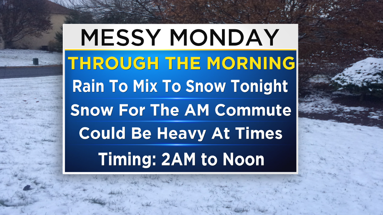
Where we are expecting the most snow is generally north of Philly where 2-4" of wet snow is likely in the north and west suburbs. While the city and much of the immediate area is in the coating to 2" range, a few spots, especially just north of I-95 could potentially see up to 4" thanks to some heavier snow bands that could work their way through with snowfall rates in the 1-2" per hour.
The good news about this system is it is quick moving so it likely will be out the region by lunchtime or just after and we could even see some rays of sunshine break through the clouds as we move into the later half of the afternoon.
The unsettled pattern continues throughout the week as temperatures fluctuate and we continue to monitor the chance for rain showers as well as another chance for wintry mix.