Third Nor'easter Of March Works Into Philly Area Tonight
PHILADELPHIA (CBS) -- Another week, another chance for a Nor'easter and snowfall across the Delaware and Lehigh Valleys, as well as the Jersey Shore and Poconos.
The pattern for the start of March really does not get more active than what we have been seeing as low pressure systems have been rolling off the Carolina coastline up into the the mid-Atlantic and New England on almost a weekly basis it seems like. The good news about the system this week is that it is the weakest of the three storms that have come through the region so far this month.
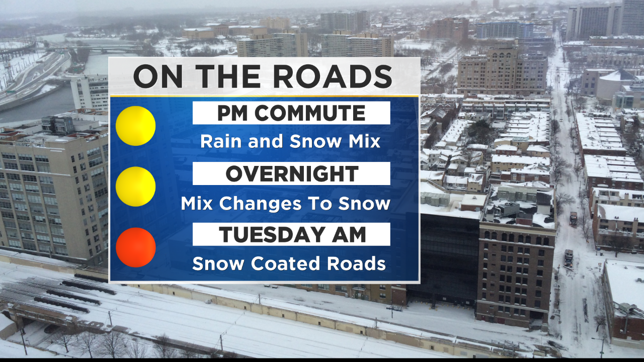
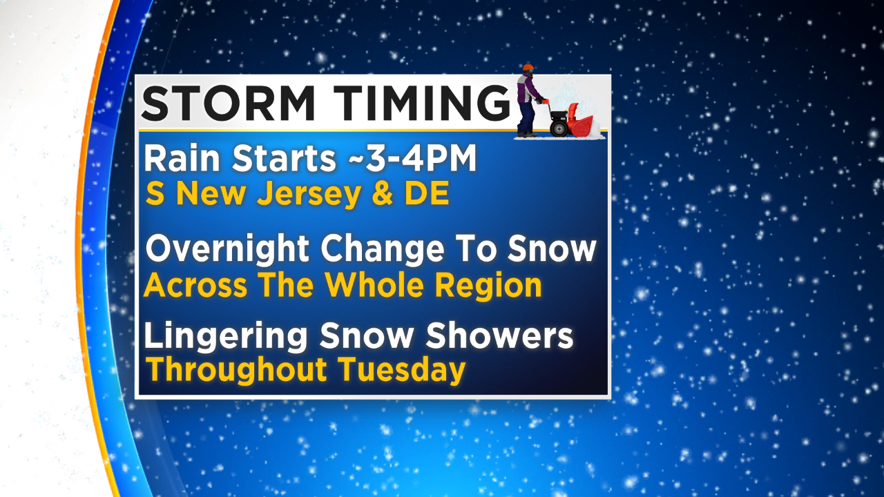
The storm system starts to push into the region later in the afternoon and then the evening hours, likely starting as some light rain in areas south of Philly before changing to a wintry mix and then all snow eventually. We could start to see precipitation in the area as early as 3 to 4 p.m. in spots in Delaware and even into South Jersey as well.
Again, this will start as rain in the early onset of the low. A mix of rain and wet snow will start in the Philly area around 5 p.m. as temperatures are still warm enough, especially near the ground, that the precipitation should not be all snow at the start. The snow and rain mix will eventually overtake the entire region and change over to all snow in Philly and likely across South Jersey and the shore points as well.
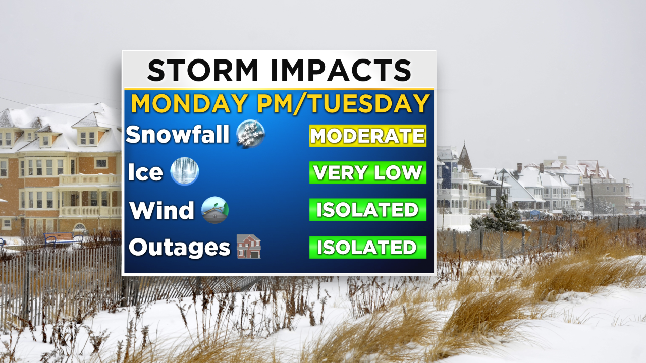
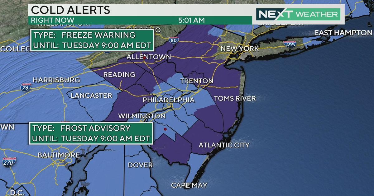
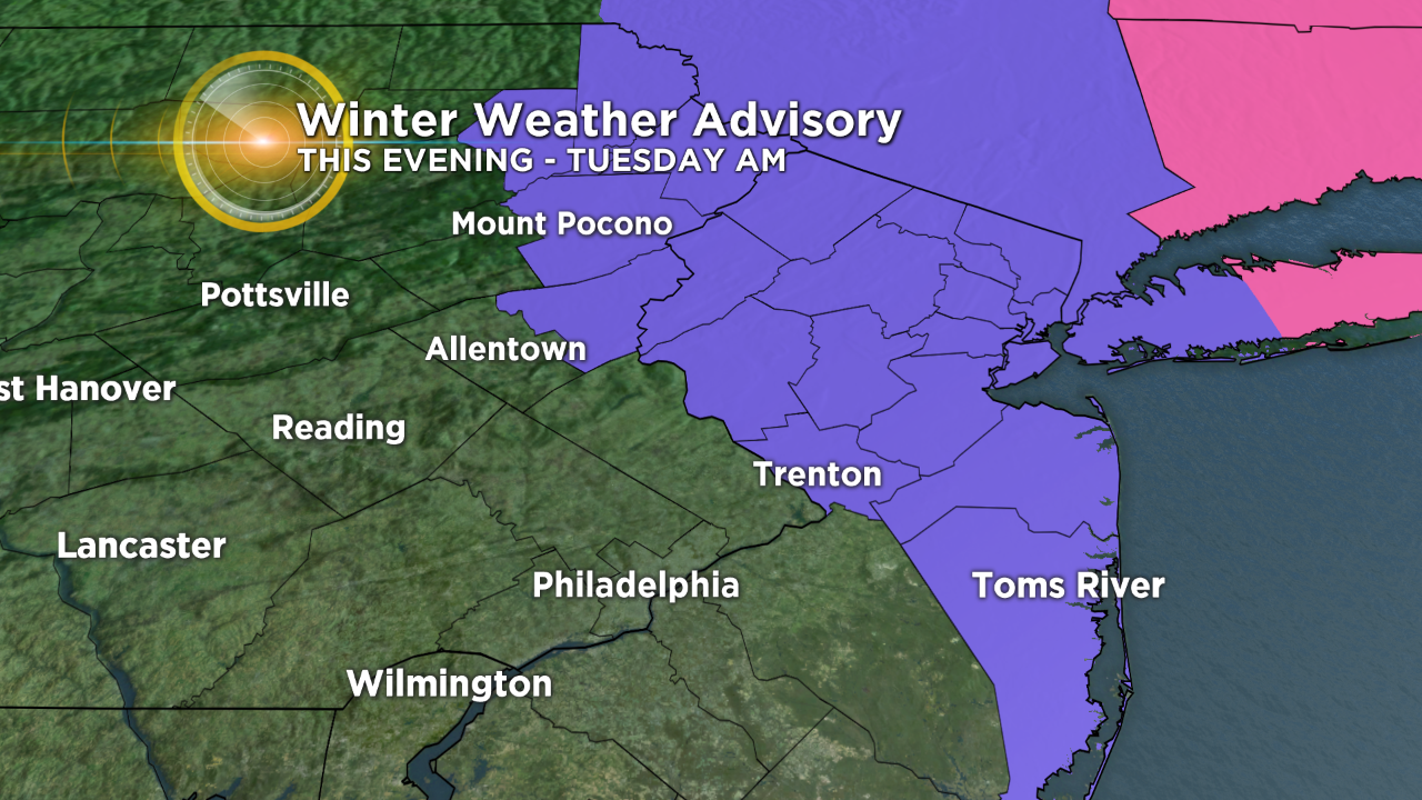
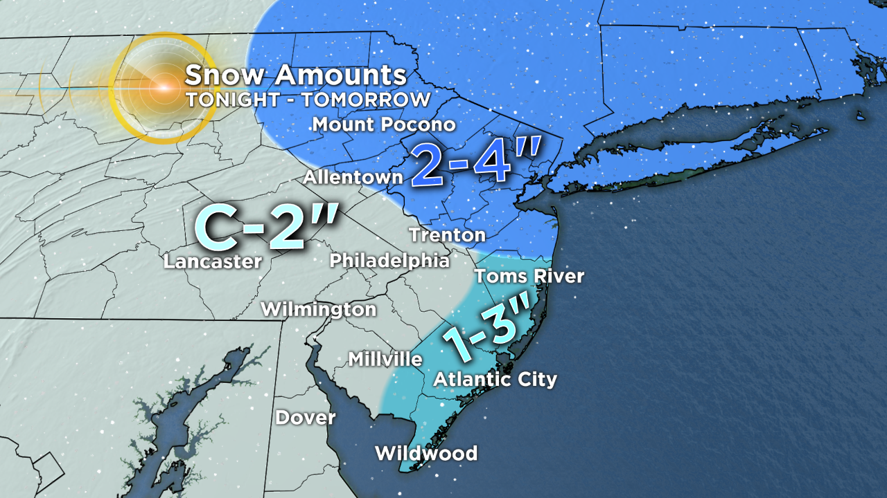
Snow showers will persist into the morning on Tuesday, but the heaviest of the snow is going to wrap up in the morning, leaving only a few lingering snow showers throughout the afternoon on Tuesday. When this is all said and done, we are looking at only a coating to 2 inches for a vast majority of the region, with the highest amounts near the shore and up into the higher elevations of the Poconos. In the Poconos we are looking at 2 to 4 inches, while the shore could get anywhere from 1-3 inches. Due to the higher amounts along parts of the shore and into the Poconos, a winter weather advisory is in place through Tuesday morning, expiring at 10 a.m.
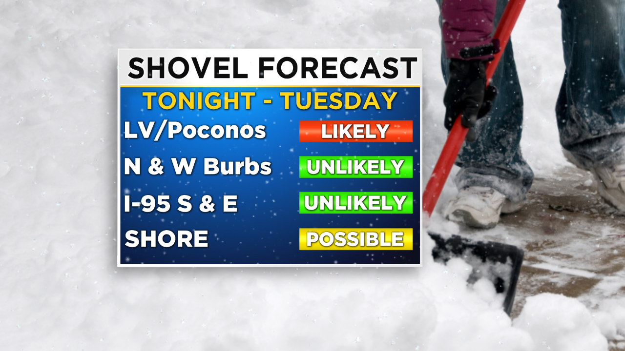
Best chance at this point to break out the shovels are going to be in the Poconos and possibly down the shore, but the rest of us are likely OK just putting down some ice melt on the sidewalks and on the driveway. There will be travel concerns due to snow-covered roads and slick spots in many areas, so make sure to hit the roads early on the drive to work, but go slow as well.
Eyewitness News is going to go on early at 4 a.m. Tuesday to keep you up to date early and often as the third round of wintry weather rolls in. Make sure to stay tuned for all the updates.