Is Nor'easter Number Three On The Way For The Northeast?
PHILADEPHIA (CBS) -- The saying that March comes in like a lion has not been truer for Philly and much of the northeast United States than it has to start out the month in 2018.
We have had eight full days so far in the month and of those eight days, snow has been recorded in Philadelphia on half of them! So far in the month of March, Philadelphia has officially received 7.6 inches of snow. Typically in the first eight full days of the month, we only see about 1.2 inches of snow and the month as a whole on average only sees 2.9 inches. Needless to say, we are well above normal when it comes to our March snow and it could get worse potentially before it gets better as another system could potentially be brewing once again.
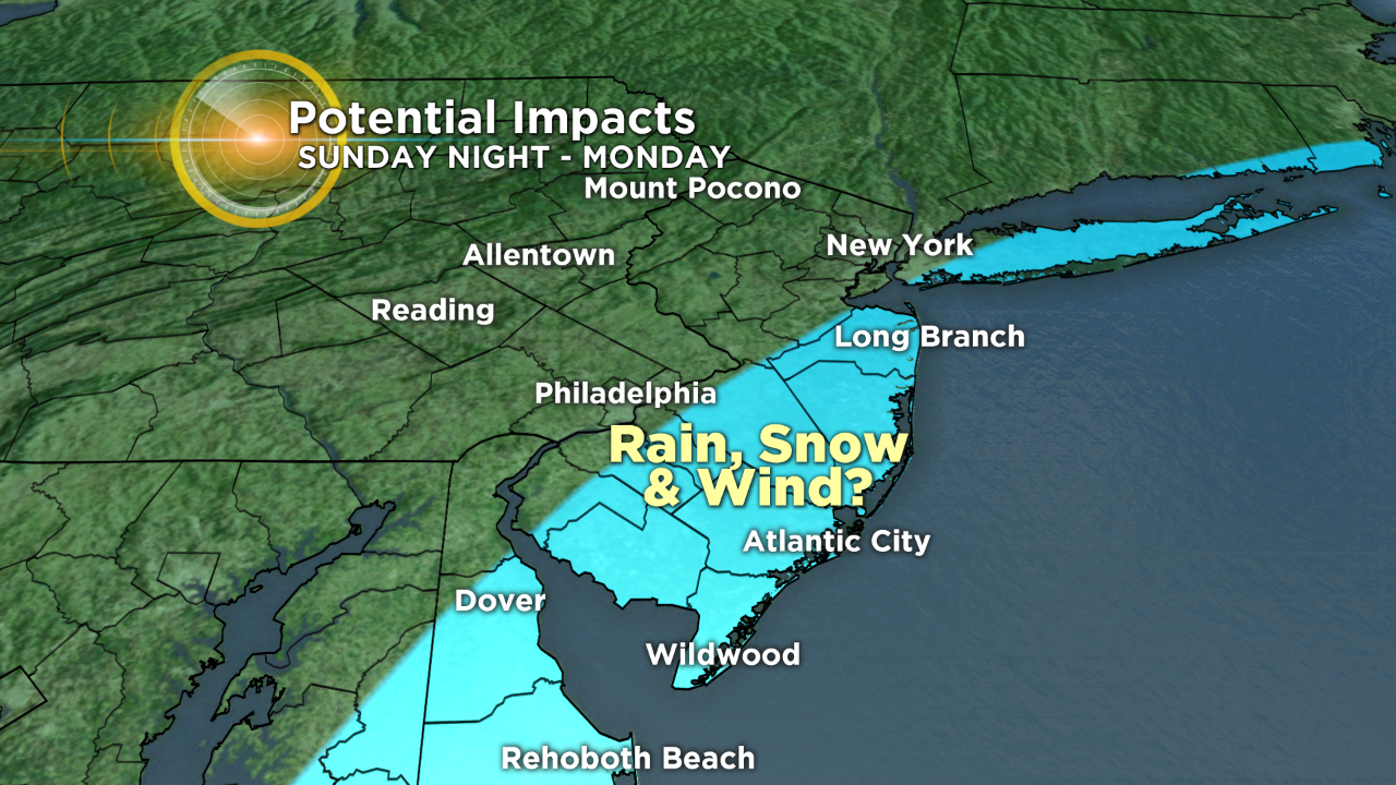
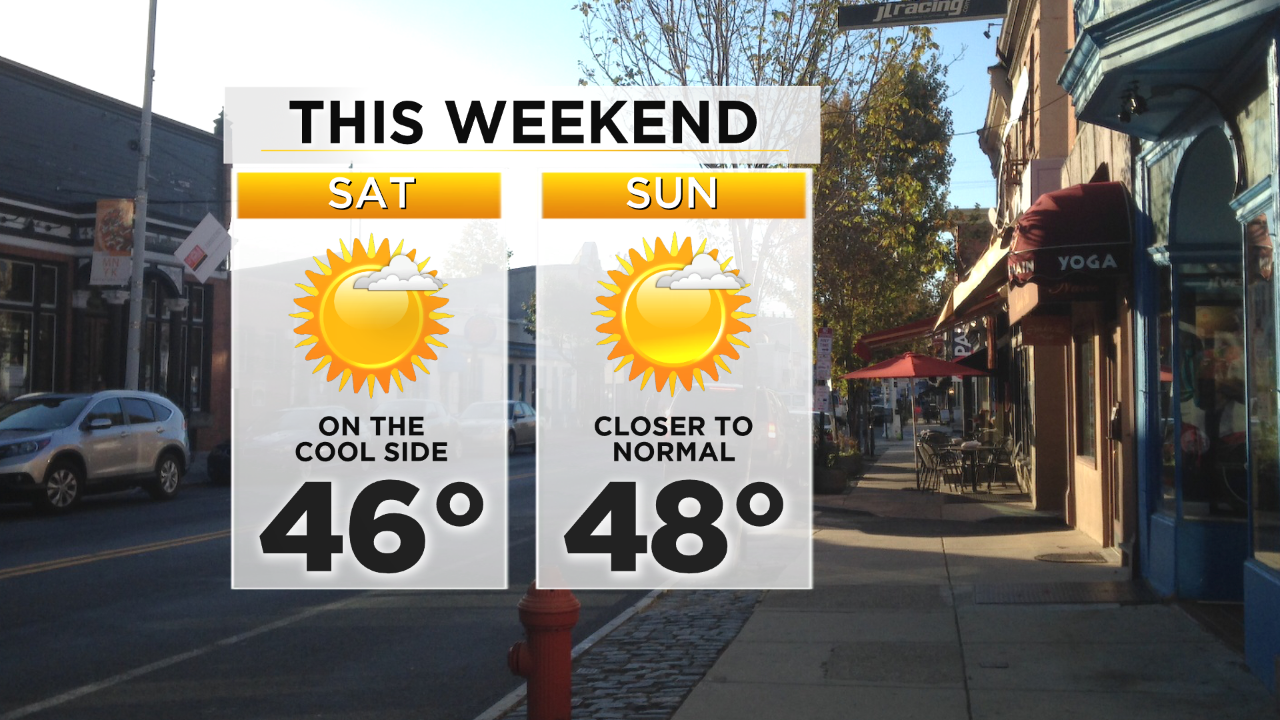
As we prepare for what should be a nice and quiet weekend for the most part across the region, our eyes are turning to the Sunday night into Monday time frame, as another potentially potent low-pressure system tries to come together and affect the region. As for before we dive too much into the forecast for Sunday night and Monday, we can talk about some cooler than normal temperatures on Saturday and Sunday as we see highs in the middle to upper 40s as well some breezy conditions, but we should have decent sunshine both days which is nice.
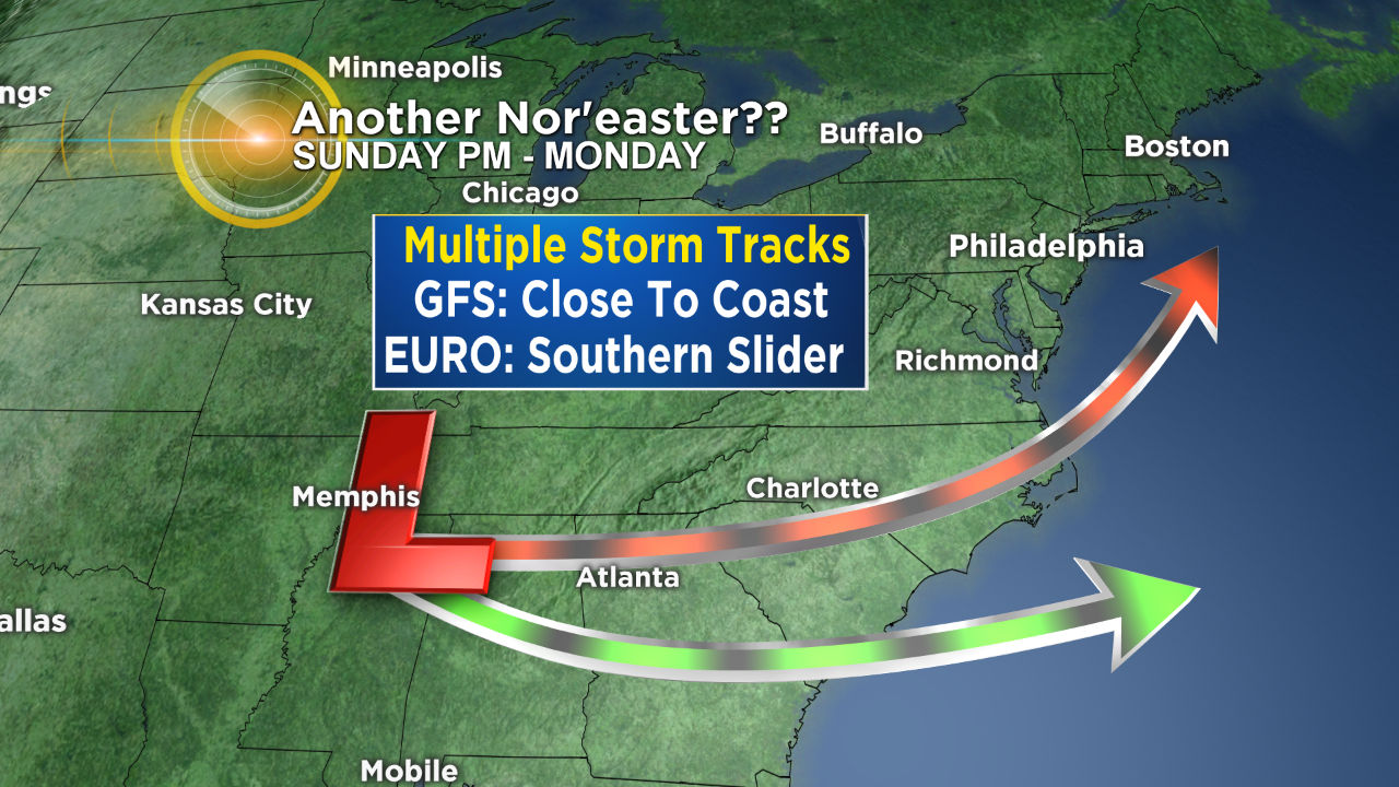
As advertised now it's time to peek toward the potential third nor'easter in only about two weeks. There is a good amount of uncertainty within this system and the picture should hopefully come into clearer view throughout the weekend, but right now we are tracking two separate solutions for this system. The first is a more American Model (GFS) based solution which allows the low to hug the coastline and possibly affect the region, especially the Jersey sections of the viewing area, with a wintry mix, rain, snow, and wind. If the GFS were to verify there is a good chance that the Philly area also gets some wintry precipitation.
The second solution and the one that right now I am more inclined to believe is that of the European Model (EURO). This solution keeps the low well to the south and pushes it off the coastline of the Carolinas, well before it can turn to the north and with the EURO solution the entire area stays dry. Again, there is still a decent amount of moving parts of this forecast but right now in this meteorologist's opinion, we are leaning toward the southern EURO based solution that keeps us dry.
Make sure to stay with the Eyewitness Weather Team throughout the weekend for all updates on this storm.