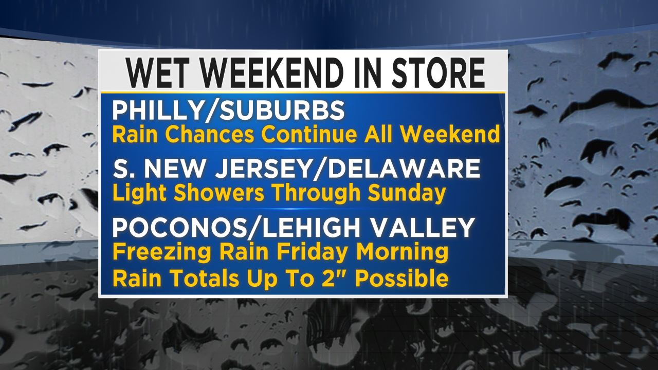
Wet Weekend In Store For Region
PHILADELPHIA (CBS) - It was a quick dose of spring weather in the middle of the work week as we saw record high temperatures across many parts of the area, before a boundary pulled across the region and temperatures regressed to the rainy weather.
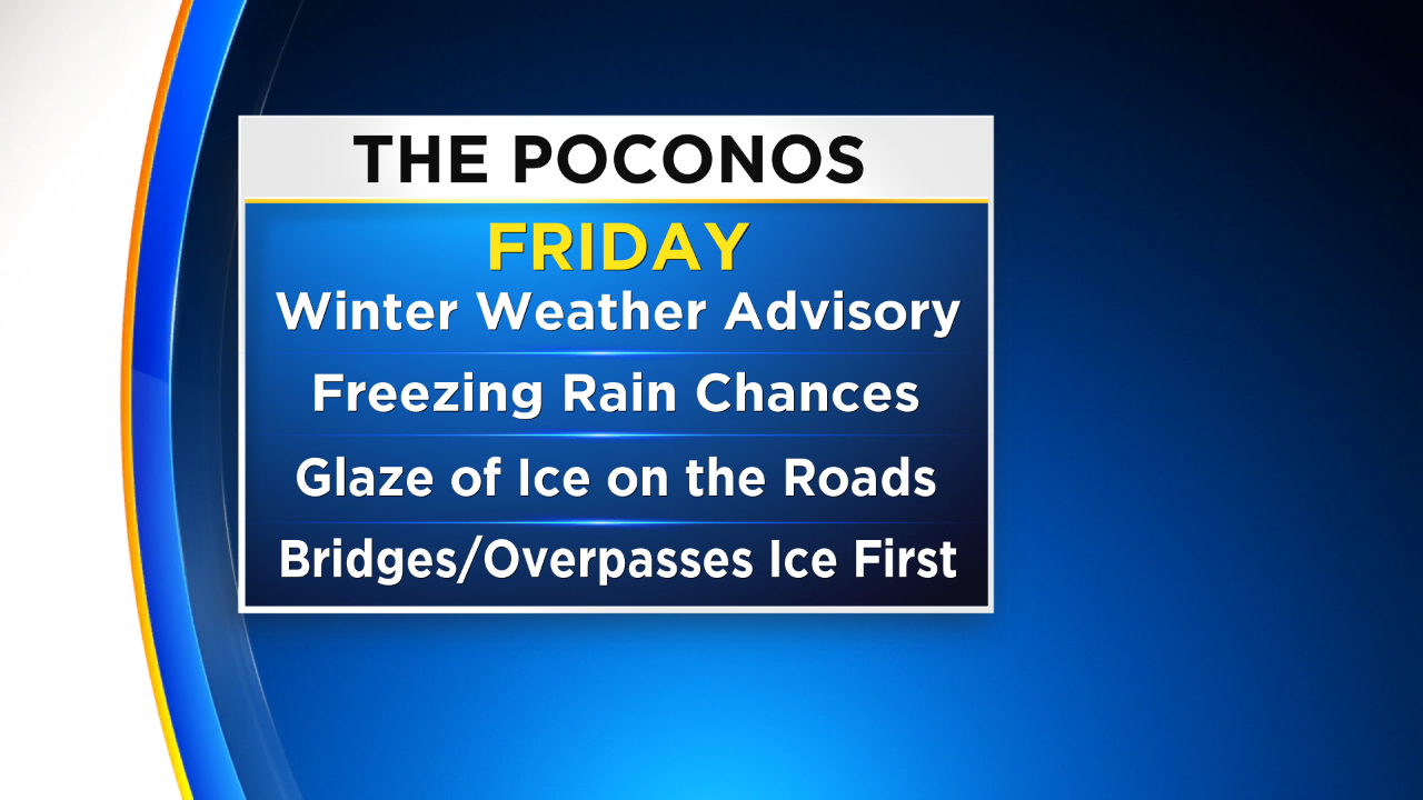
The wet pattern is going to continue through the weekend, but the good news is that temperatures should remain more than mild in the 60s, so any and all precipitation we experience across Philly and in the surrounding areas will be falling as rain. That being said, there is a chance for some wintry precipitation on Friday as temperatures will still be cold enough for a some icing and freezing to take place.
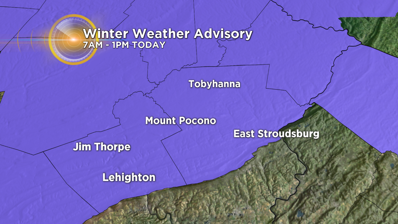
Since temperatures will be cold enough today for a small chance of icing and for some freezing, a winter weather advisory is in effect until 1 p.m. for the Poconos where travel could be affected with slippery roads at times. The good thing though is this will be a Friday-only event before warming back up.
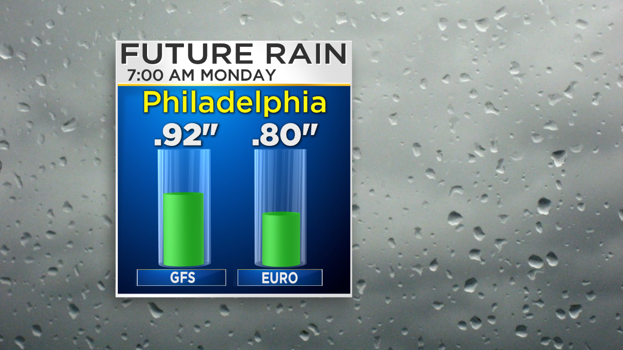
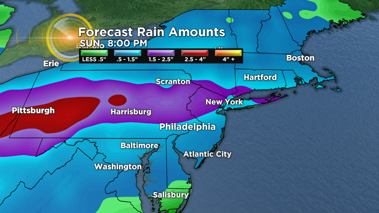
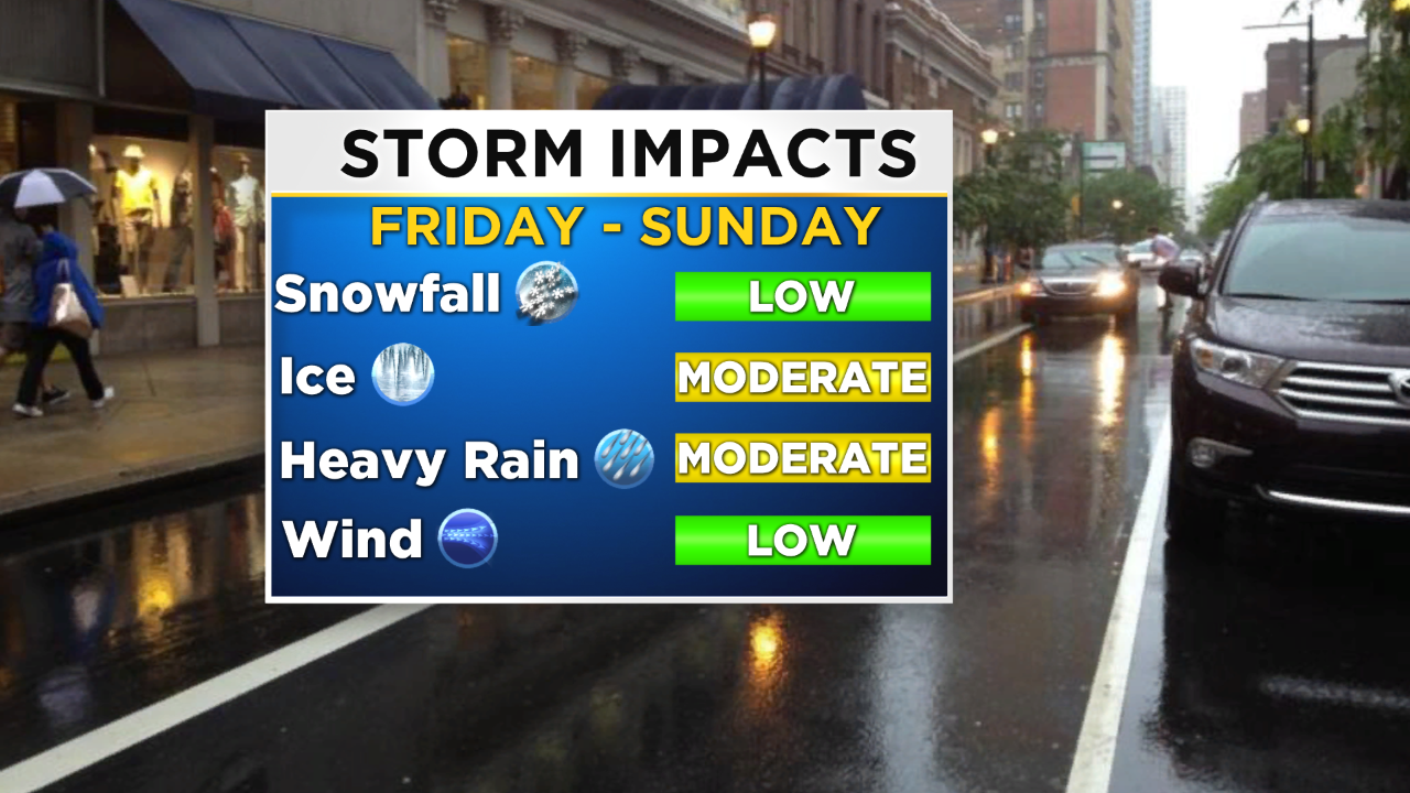
The rain that we will experience through the weekend will fall in rounds most likely, with some showers being heavier than others at times. In general, right now, it looks as though the highest totals are going to remain north of Philly in parts of the Lehigh Valley and into the Poconos as well. Highest totals are likely to be close to 2 inches in those spots. For Philly and much of the surrounding area, rain amounts will hover around an inch or some, but locally we could see higher or lower amounts depending on where you are.
After the rainy weekend we should watch for some drier conditions on Monday and Tuesday before we watch another system start to move into the region for the start of March on Thursday.
Have a great weekend and stay dry!