WEATHER BLOG: Bitter Blast Lasts, Possibility Of Snow New Year's Eve Weekend
PHILADELPHIA (CBS) -- Arctic air has checked into the Delaware Valley and it's planning on an extended stay. The temperature has fallen below the freezing mark this evening in Philadelphia and will not again surpass that threshold for more than 180 hours.
Wednesday, begins a prolonged period of bone-chilling high temperatures in the 20's and morning lows in the teens.
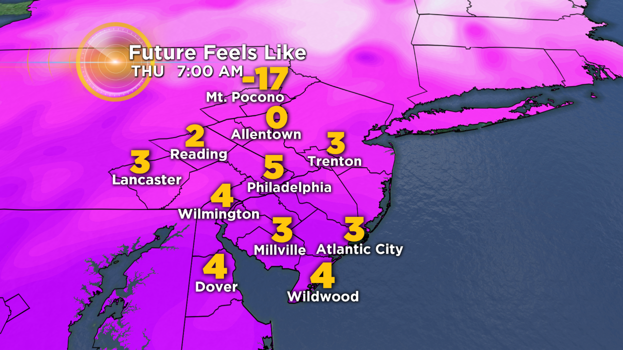
The coldest of the bitter cold occurs on Thursday morning with lows in the low to mid teens in the city and suburbs and wind chills nearing zero.
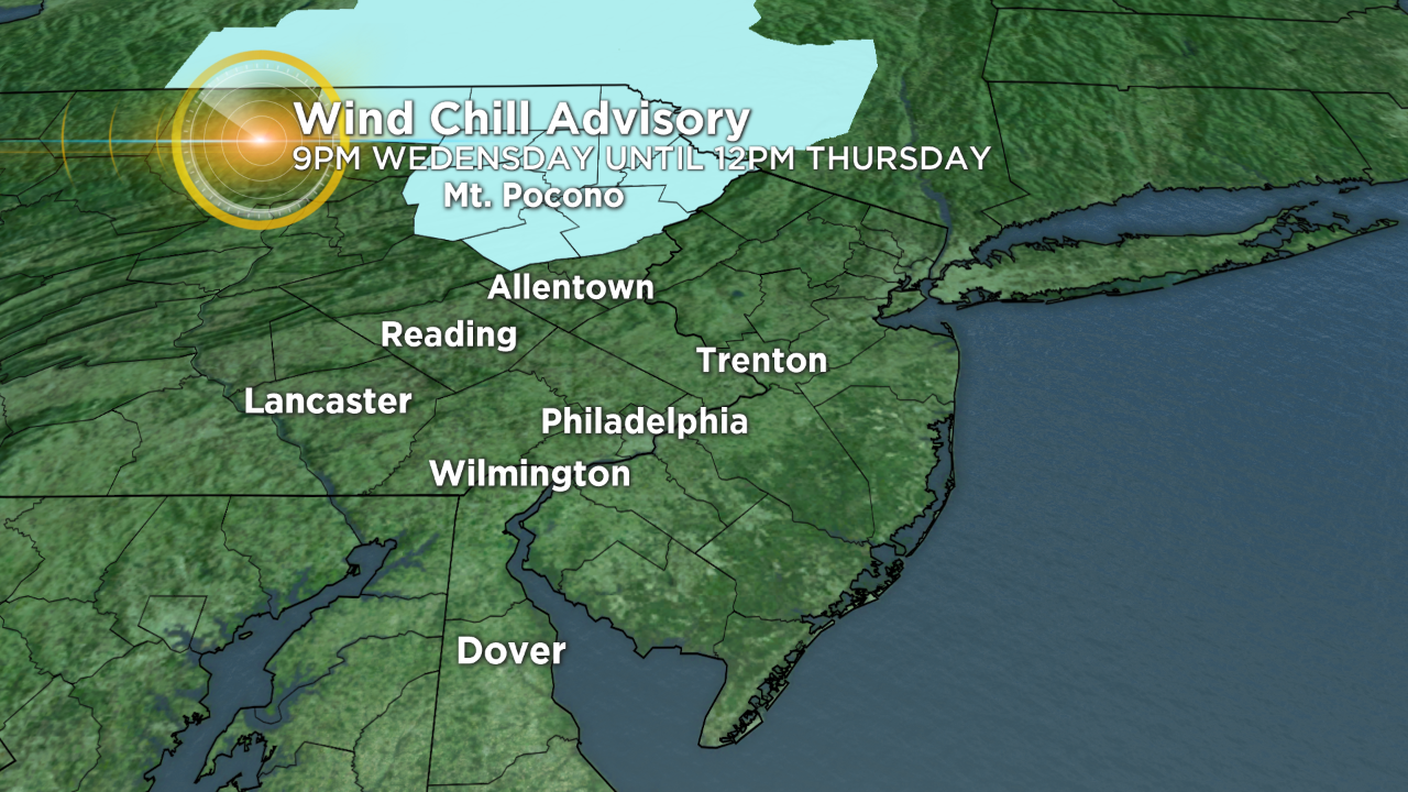
In the Poconos, a Wind Chill Advisory has been issued for Carbon and Monroe counties 9 p.m. Wednesday to noon Thursday as wind chill values will near -15 to -20 degrees. In these conditions, frost bite is possible within 30 minutes.
A storm system off of the East Coast on Friday will strengthen as it departs east and may bear enough energy and moisture to bring scattered snow showers to the area on Friday and Saturday.
Models are still in disagreement regarding snow chances so be sure to stayed tuned to the evolving forecast.
A re-enforcing blast of arctic air this weekend, holds high temperatures in the 20's through the new year.
A forecast high of 25 degrees on January 1st, would be the coldest New Year's Day in 41 years. Since 1874, there have been only 12 sub-30 degree New Year's Days in Philadelphia.
- TONIGHT - Frigid with Increasing Clouds. Low 19.
- WEDNESDAY - Morning Clouds then Mostly Sunny and Very Cold. High 28.
- THURSDAY - Mostly Sunny and Bitter Cold. High 25.
- FRIDAY - Cloudy and Very Cold with Scattered Snow Showers. High 29.
- SATURDAY - Mostly Cloudy with a Chance of Snow. High 28.
- SUNDAY (NYE) - Partly Sunny and Still Frigid. High 29.