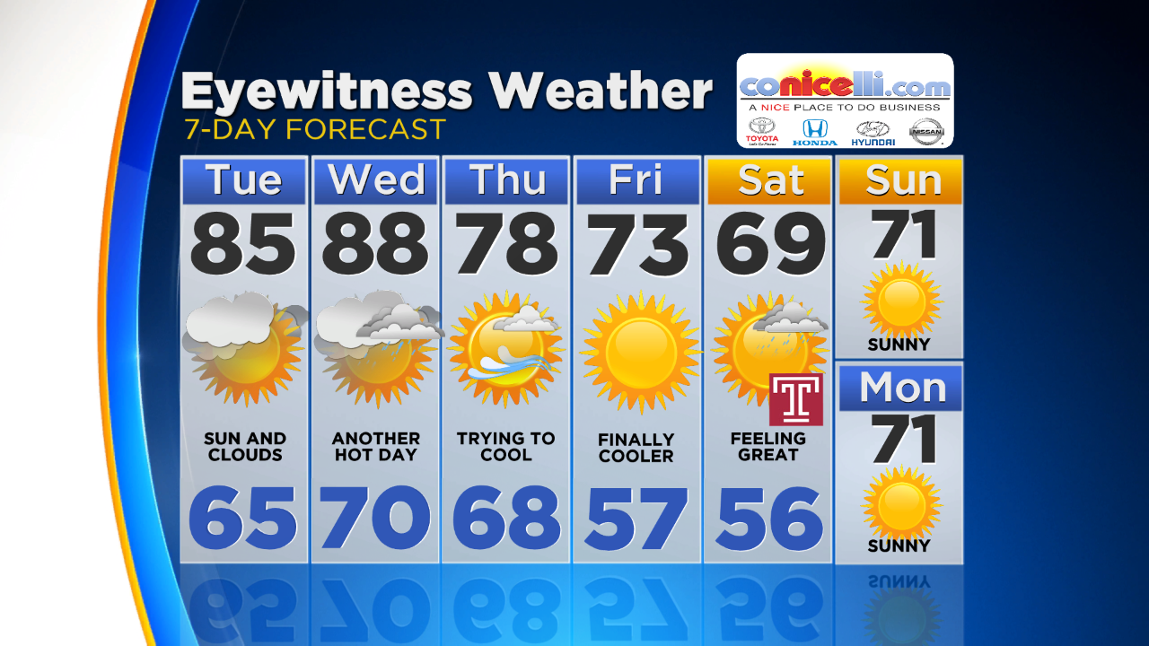
Summer Heat Sticking Around But Relief Is On The Way
PHILADELPHIA (CBS) -- As we all know Fall officially started last Friday afternoon, but since the second half of last week, we have felt anything but Fall-Like. It doesn't looks as though the next couple days are going to offer any relief but eventually by the end of the work week we should finally get a decent taste of nice crisp and cool weather.
The reason we have been so warm lately is this ridge in the jet stream that as allowed for warm and tropical air to continuously flow into the region on the back of a southerly upper level wind. As we progress through the rest of the work week though, a fairly strong cold front will eventually push through, clearing out all levels of the atmosphere from the ground up to the level of the Jet Stream and that means we are likely to see much less humid conditions as well as temperatures much closer to average.
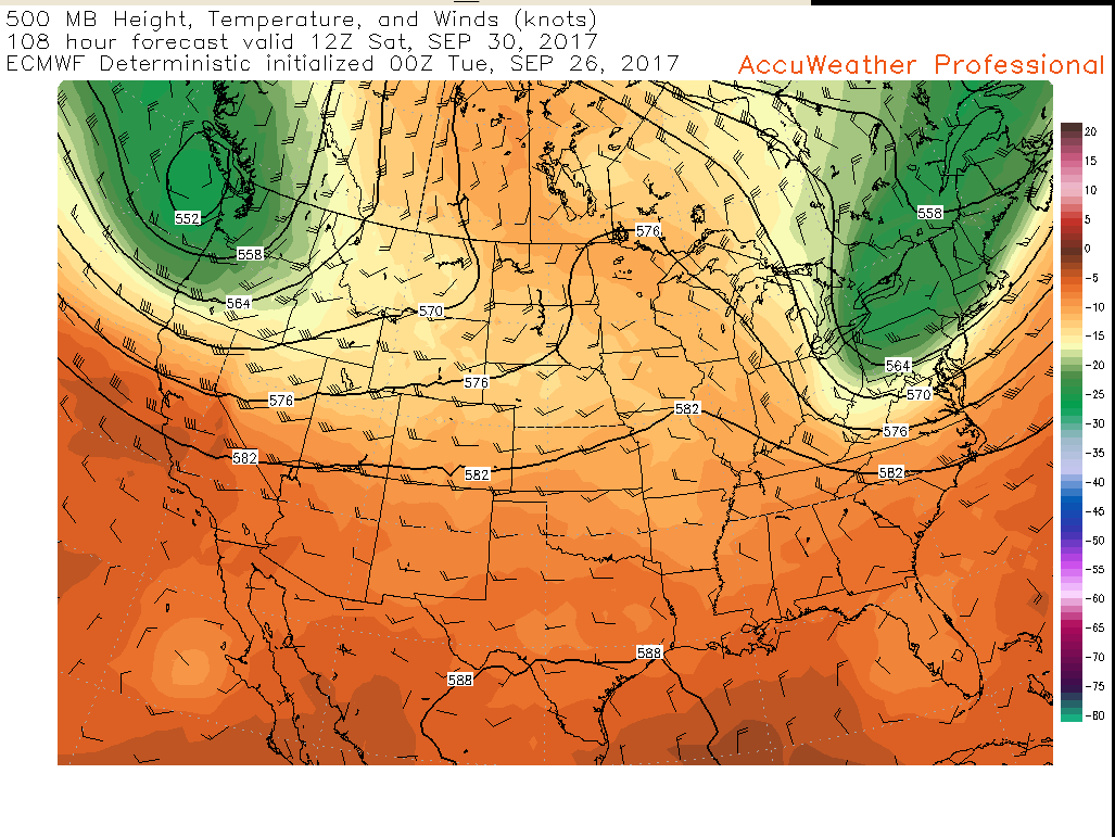
Here is a peek into the future on both the American (GFS) Model as well as the European Model. These maps show the temperatures as well as the atmospheric height at the 500mb level, or about halfway up in the atmosphere. This is a good indication of what can translate down to the ground, since it is not too high that the air is always too cold, but not too low as to be warmed too much on a daily basis by the sun. Each of the pictures shows the same time, 8AM Saturday morning. You can see in each snapshot that an area of cooler air (green shading) and lower level heights, move over the Mid-Atlantic and the Philly area on Saturday.
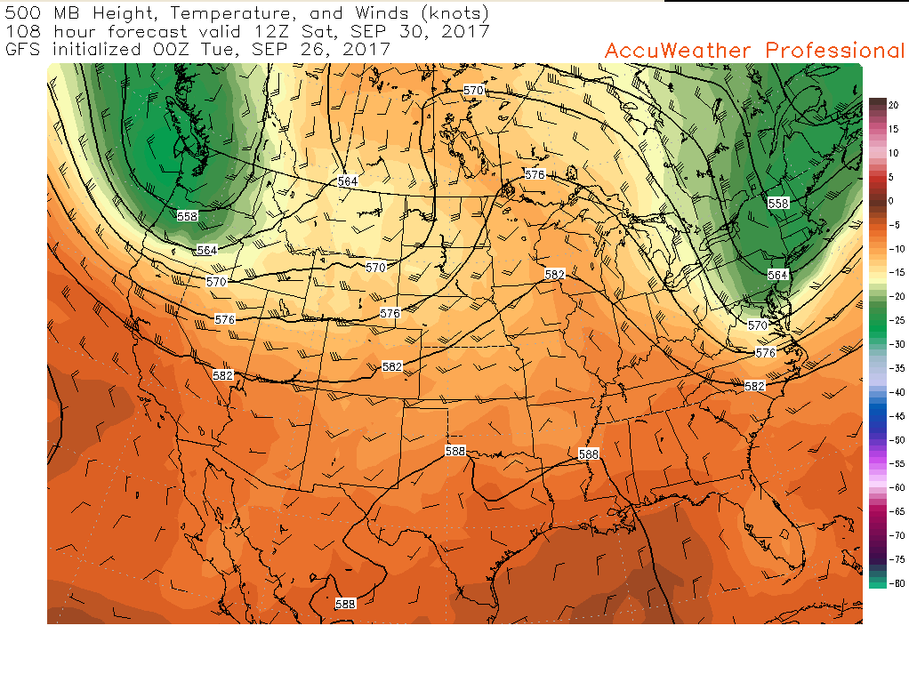
The only difference is in the timing. Right now the GFS is a little quicker with the cold front and upper level trough that brings in the cooler and drier air, but either way we are looking at a very good chance that we are more seasonable and possibly even a little chilly at times come this weekend. The comfortable air should filter into at least the start of next week as well.
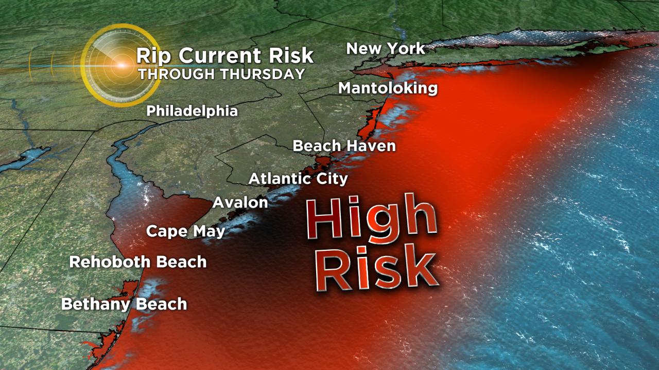
The tropics remain a topic of conversation thanks to Maria which is still churning away off the east coast of the U.S. The aforementioned cold front that cools us will actually play a role in what happens with Maria as well.
Before we get into the track of Maria we need to talk about what it will do along the Jersey and Delaware coastlines. Right now we should not be worried about any kind of direct impact from this storm. What we do need to be vigilant about though is rough surf as well as strong rip currents.
As long as Maria is close enough to the shore, it is best to stay out of the water, and that could be well into this weekend if you are a late season shore person. As for where Maria is going to go, it will continue its slow track North for the time being before being swept up into the cold front and pushed very quickly out to sea. This will not happen until the end of the work week though.
Make sure to stay with the Eyewitness Weather Team for all your weather updates.