Dangerous Cold Friday Followed By A Weekend Warm-up
By Geoff Bansen
PHILADELPHIA (CBS) -- We fell just shy of the record low temperature in Philadelphia, bottoming out a degree short at 2°, but new records have been reached in both Trenton and Wilmington.
Records or not, we are talking about some dangerous conditions. Almost everyone in the Delaware Valley is experiencing face-numbing cold and wind this morning.
Despite sunshine and dying winds later today, the way-below-average temps will stick around until tomorrow morning. After again flirting with records Saturday morning, temperatures take a turn for the better. Based on the way things have been lately, some might refer to this weekend as sultry! Highs later Saturday will break the mid 30s before eventually rising above 40 after midnight into Sunday.
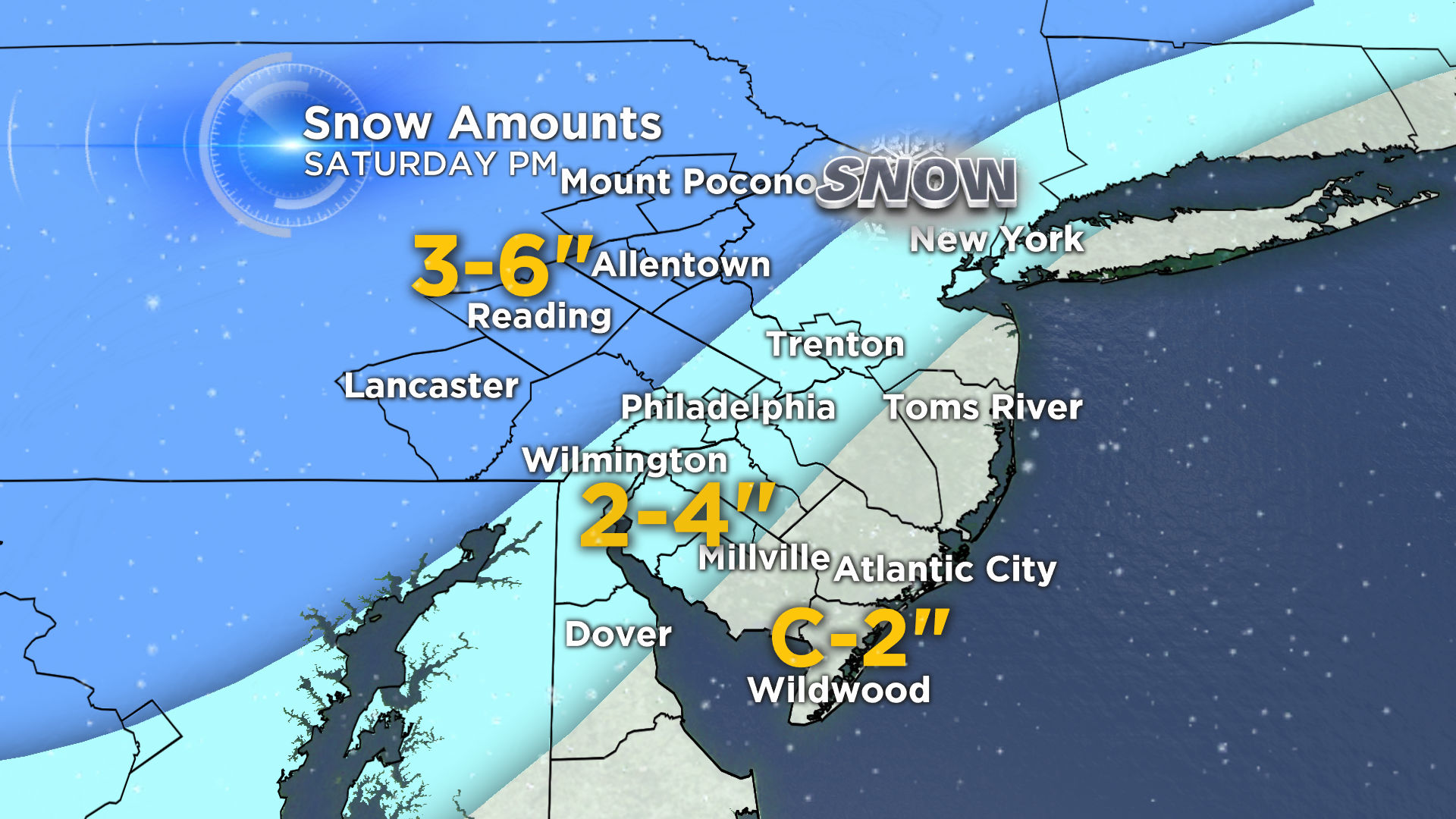
Unfortunately, precipitation will be moving back into the picture during this time. Initially beginning as snow Saturday afternoon, it will changeover to an icy rain Saturday night and eventually all plain rain by Sunday. Before the changeover, snow will accumulate quickly across the region. Here is the latest exclusive CBS3 snow map:
The rain will taper off Sunday morning, but that daytime high of 45 will probably feel a lot warmer after what we've had to put up with. Don't get too used to it; below average temperatures are back for the last week February. This month could go down as one of the coldest Februaries in history.