1-2 Punch Of Messy Weather To End This Week And Begin The Next!
***WINTER WEATHER ADVISORY IN EFFECT FROM FRIDAY EVENING UNTIL SATURDAY MORNING***
AIR QUALITY ALERT IN EFFECT FOR SOUTHEAST PA AND DELAWARE
By Geoff Bansen
PHILADELPHIA (CBS) -- We are now under 24 hours away from our next big storm, and the big picture is becoming clear on what we can expect.
After a generally sunny start, clouds will soon build ahead of the system. By late Friday night, the first flakes (and a few drops) will begin to fall across portions of the Delaware Valley, slowly spreading from south to north.
A steady snow will develop across the area, continuing to fall until dawn. As temperatures slowly rise, the snow will begin to change to rain, much of it freezing, but not before dropping several inches.
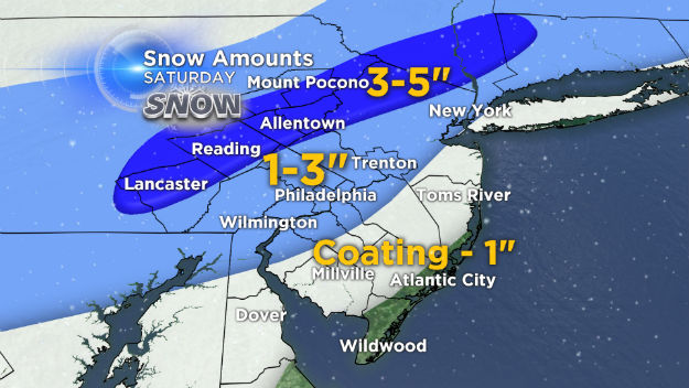
Areas to the north (Poconos/Lehigh Valley) will be the last to change over and could see anywhere from 3-5". Totals will be slightly less around Philadelphia and the adjacent suburbs, approximately 2-4". The shore will be impacted the least, as it will change to rain there first. They can expect a coating to an inch before then.
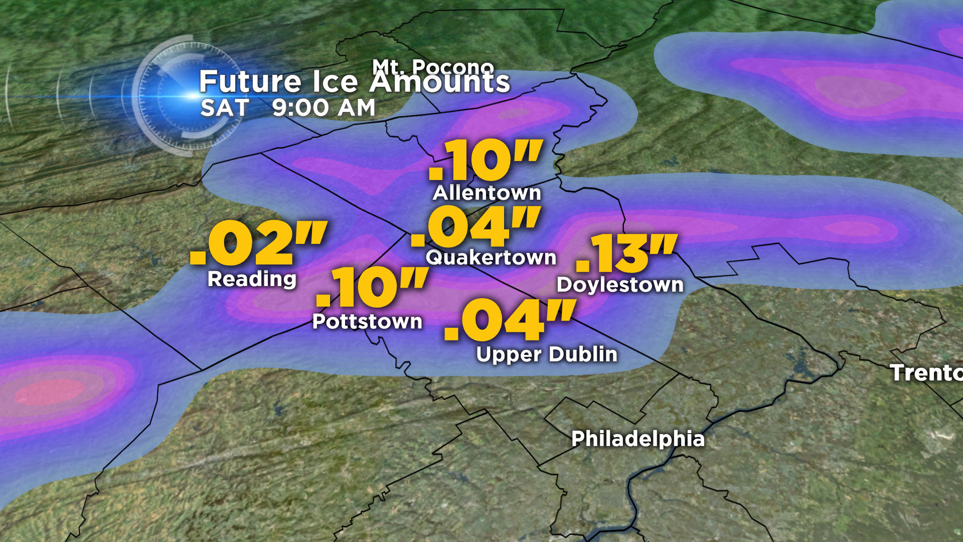
The window for freezing rain will be in the early morning hours, and the places most likely to see some icy conditions will be to the north of Philadelphia.
Although the air temperature will creep above the freezing mark, much of the ground surface will still be cold enough for water droplets to freeze on contact. While driving at any point overnight is not recommended, it may be even more treacherous on the roadways during this period.
Eventually, most of the Delaware Valley will change to rain, much of it heavy. The increased start time of this storm will also mean a quicker end. We expect the precipitation to taper off by the mid afternoon to early evening.
Here in Philadelphia, we have been tightrope-walking that rain/snow line all winter long, and this storm will be no exception, an indicator of just how pertinent patterns in weather can be.
Sunday will offer only a temporary reprieve, as we have another system to talk about Sunday night into Monday. An Alberta Clipper, similar to the one from this past Wednesday, will scoot down from Canada and move east. It will spread across the area from west to east, the earliest flakes falling late Sunday. The air should stay plenty cold enough for a solely snow event, which will last through Monday morning. It is going to be a MESSY commute to start of the work week, and caution will need to be exercised.
Behind Monday's system dry weather will return, with a catch: temperatures plummet - subzero wind chills are possible for the area Tuesday into Wednesday with daytime highs no better than the twenties!