Our 13th Snowfall Could Put Winter Of 2013-2014 Into History Books
By Kathy Orr
PHILADELPHIA (CBS) -- Our 13th Snowfall Tuesday morning will put the Winter of 2013-2014 into history!
It will be the 3rd Snowiest Winter ever in Philadelphia.
Snowy & Slick AM Commute
A WINTER WEATHER ADVISORY IS IN EFFECT FOR MOST OF OUR REGION, EXCEPT COASTAL AREAS, Through 11AM.
Low pressure over the Midwest will move eastward and bring a round of snow into our area Tuesday Morning. Low temperatures will fall into the mid-20s with temps slowly climbing into the 30s Tuesday morning.
TIMING:
The heaviest snow will occur between 4-8am with snow rates of 1" an hour at times. The snow will mix with and change to rain in south NJ and central Delaware. The snow and rain will end between 10am–12noon.
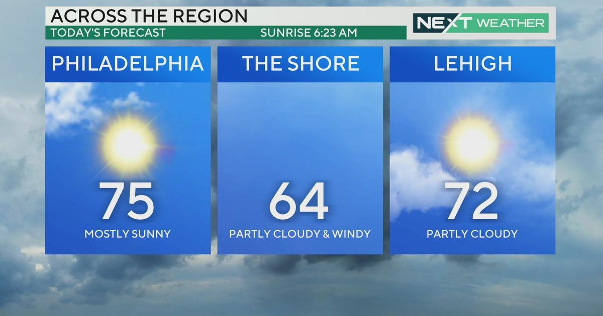
Skies will gradually clear in the afternoon with highs reaching the low 40s.
AMOUNTS:
Expect Snow amounts of 2-4" for Philadelphia and surrounding PA, NJ and DE suburbs and up through the Lehigh Valley. 4-6" is possible for the Poconos. Expect lesser amounts of 1-2" for south NJ and central Delaware and little to no accumulation for the Shore and Delaware Beaches.
IMPACT:
Expect Slow and slippery travel during the morning rush. Many roads, especially North & West of Philadelphia, will be snow covered.
Visibility will be reduced to ½ mile at times.
AFTER THE STORM:
A pattern change will then get underway for the second half of the week, with a warm front moving through.
Expect high temperatures to climb to normal or above, in the 40s and 50s, from Wednesday through the weekend.
There is a good chance of rain on Friday with highs well into the 50s. Temperatures stay at or above average through the weekend.
Kathy Orr